On this page...
These automation transportation projects will improve the automated driving systems in Iowa.
Back to topAudible Attenuator Warning System

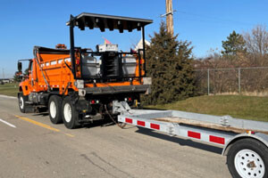
The Iowa DOT currently uses an audible warning system on maintenance vehicles equipped with an attenuator. However, the system must be activated manually by the driver of the attenuator truck who must also scan their rear-view mirror for dangerous approaching vehicles. When this happens, the driver engages rear-facing lights followed by a very loud horn. Driving the truck and ensuring that no cars approach and hit the truck from behind is like asking someone to look forward and backward at all times. The objective of this effort is to automate the triggering of the audible warning system to improve worker safety and prevent crashes.
Back to topAutomated Driving Systems for Rural America

The Driving Safety Research Institute at the University of Iowa was awarded a multi-million-dollar grant project and the Iowa DOT is a partner with this project to study the impact of automated driving systems in rural America.
The project tests the use of a custom vehicle with advanced automated technologies on rural roadways. Rural roads present unique challenges and are currently underrepresented in automated driving system research today. At the same time, the project will study automated driving system applications for aging, transportation-challenged rural populations aimed at improving their mobility and quality of life.
For more information on this grant project go here: https://adsforruralamerica.uiowa.edu/
Back to topImproved Work Zone Data Feed

The Iowa DOT is focused on improving work zone data through establishing an accessible and timely work zone data feed which will be beneficial both internally and to those outside the agency. This project provides a hands-on trial for obtaining the data and improving the data formats/feeds to be shared. This effort is focused on integrating data collected by the Iowa DOT with devices in the field which can verify the spatial and temporal extents of the work zone. Devices in the field can include but are not limited to connected pins, connected traffic control devices and smart arrow boards.
The Center for Transportation Research and Education at Iowa State University is supporting the Iowa DOT by leading the coordination and implementation of work zone technology deployment and implementations. The center developed a process which leverages the Iowa DOT linear referencing system to automate associating connected temporary traffic control devices (smart arrow boards, connected pins, etc.) to 511 events. This provides an adaptable solution that can be modified for travel management systems in Iowa and can potentially be expanded to other agencies within or outside of Iowa.
Back to topRoad Weather and Operations

Safe mobility in Iowa’s extreme weather conditions relies on accurate and timely data provided both to Iowa DOT maintenance crews and the public, allowing them to make better travel decisions during inclement weather.
In recent years, the United States Department of Transportation’s Federal Highway Administration and Research and Innovative Technology Administration joined forces to promote safety, mobility, and improve the environment of the nation’s surface transportation system through a new connected vehicle initiative. This initiative aims to enable wireless communications among vehicles, the infrastructure, and passengers' personal communication devices. The long-term goal for connected vehicles includes the collection of vehicular and environmental status data by millions of passenger and commercial vehicles.
In working with our federal partners, the National Center for Atmospheric Research has developed the Pikalert System to ingest and quality-check these vehicle observations, and then combine the vehicle data with more traditional weather data (e.g. radar, satellite) to assess road condition and road hazard information.
Timely, safe, and efficient winter travel is a high priority for the Iowa DOT. The National Center for Atmospheric Research worked with the Center for Transportation Research and Education at Iowa State University to enhance and deploy the Pikalert system in Iowa.
This project integrates weather, vehicle, and roadway data and provides roadway weather forecast capabilities 72 hours in advance for all Iowa DOT primary roadway segments. With the web-based Pikalert tool in place, our agency activities will focus on providing system support over the winter, analyzing Pikalert performance and accuracy, obtaining user feedback, and making minor enhancements to the interface.
Back to topStatewide Pavement Marking

The Iowa DOT recognizes the critical role pavement markings serve in providing guidance to drivers and in enabling advanced driver assistance systems like lane departure warning which has been estimated to potentially reduce 29 percent of all fatal crashes. The Iowa DOT Pavement Marking Task Force, with support from the Center for Transportation Research and Education at Iowa State University, is developing a statewide strategy consistent with other state DOTs and national efforts to improve safety, mobility and to enable higher levels of automated driving.
This work has consisted of developing a multi-component pavement marking specification, working with DOT staff to develop drawing standards, and establishing a marking approach using wider lines (from 4 feet to 6 feet), better materials, and contrast stripes for higher detection. The developmental specification is being implemented on projects across the state. Recent activities include making refinements to the developmental specification in terms of application, materials, wet recoverable media, and grooving techniques. Working with the Pavement Marking Task Force to assess and estimate the costs for the new materials across the interstate system and working with districts in using/inspecting the installation of these new materials.
This pavement marking project is an example of Iowa supporting the two-prong approach to deploying automated transportation strategies for drivers and driver assistance today and automated driving systems of tomorrow.
- 6" (Wider) Pavement Markings using a long Life Marking Material
- Grooved in Wet Weather White Skip Line with Shadow Stripe for high contrast
- Durable Legends at the top of each interstate ramp (arrows, only, stop bar, crosswalk)
Work Zone Data Exchange Project

The U.S. DOT Work Zone Data Exchange project aims to make travel on public roads safer and more efficient through easy and complete access to data on work zone activity for public and private entities. This data can be used to produce products like 511 Traveler Information or in-car navigation. Up-to-date information about changing conditions occurring on roads - such as construction events - can help everyone navigate their trip more safely and efficiently.
This project was inspired by the General Transit Feed Specification and was launched in March 2018 to jumpstart the use of a standardized work zone data feed specification through collaboration with groups who produce and use that data.
The Center for Transportation Research and Education at Iowa State University is supporting the Iowa DOT with research and technical assistance in the development of a work zone data feed as well as involvement in the U.S. DOT committee for the project.
For more information visit: Data for Automated Vehicle Integration or Work Zone Data Exchange (WZDx) Specification
Back to top