Iowa Transportation Map
The Iowa Transportation Map shows interstates with exit numbers, highways, mileage between cities, points of interest and more.
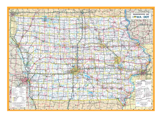
View & Print the Map
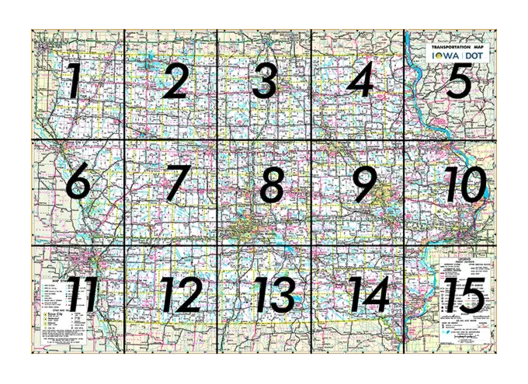
State Transportation Map Sections
Choose from among 15 sections of the state to view and/or print.
City Index, County Index, and Mileage Chart
City Detail Maps
Websites listed and previously published maps
Where can I get a map?
Get the Transportation Map on Your Smartphone
Access the map on mobile using the link, or scan the QR code to get the map directly.

Geospatially referenced PDF map
Download the PDF Maps app by Avenza Systems, Inc. to view the geospatially referenced PDF map on your iOS or Android mobile device.
Link to the map directly from our map server (22.02 MB) Archived .pdf . Find other maps on the main Avenza map store page.
These PDF maps are geospatially referenced and allow the application's location-based tools to be used. Users can determine their current location shown as a dot on the map, find places, and mark waypoints.