On this page...
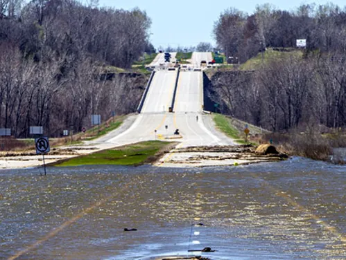
In 2021, our Resiliency and Sustainability Committee began developing a Statewide Flood Resiliency Analysis that was eventually integrated into the State Long-Range Transportation Plan. The group worked to develop a data-driven method to identify and assign a score to specific sections of interstates, U.S. and state highways that are most vulnerable to a 100-year flood event. That score allows Iowa’s decision-makers to prioritize construction projects geared to reinforce areas that may be more vulnerable to flood damage.”
Back to topResults
The analysis helps identify roads where there is a greater risk of flood events and helps us determine where additional work could make the roads stronger related to flooding. The overall distribution of composite ratings ranged from 36.6 to 93.4, with an average of 82.4. Roads of most concern from a long-range planning standpoint, are those roads that had a composite score one or more standard deviations below the statewide average. There are 72 such roads that have a composite score of 75.1 or less.
View a full-size interactive map
Back to topAnalysis Structure
To come up with the score, the team looked at three broad components with seven individual factors for each component. The goal was to develop a composite score that would help us determine which roads were more vulnerable to flooding.
Back to topAward Honors
In October of 2022, we won an award for our Statewide Flood Resiliency Analysis in the category of Transportation Planning from Iowa’s chapter of the American Planning Association. This award honors efforts to increase transportation choices for all Iowa travelers.
Back to topContact
For more information about the Statewide Flood Resiliency Analysis, please contact:
Back to top