Official State of Iowa Website
Agencies A-Z Programs & Services
Back to home page
Department of Transportation

Main navigation

  • Driver’s Licenses & IDs
    • Schedule an Appointment
    • Find a DMV Location
    • Get or Renew Driver's Licenses, IDs & Permits
    • Cancel or Reschedule an Appointment
    • Driver Education
    • Other Services
    • New to Iowa
    • Commercial Drivers
    • Suspensions & Revocations
    • Mobile ID
    • Military Services
    • Investigation & Identity Protection
    • Forms
  • Registration & Plates
    • Schedule an Appointment
    • Vehicle Registration & Titles
    • Disability Parking & Services
    • License Plates
    • Buy & Sell Vehicles
    • For Dealerships
    • Other Vehicle Services
    • Investigation & Identity Protection
    • Forms
  • Modes of Travel
    • Roads & Highways
    • Public Transit
    • Rail
    • Aviation
    • Bikes
    • Personalized Travel
    • Trails
  • Motor Carriers
    • Get Oversize & Overweight Permits
    • IFTA (International Fuel Tax Agreement)
    • IRP (International Registration Plan)
    • UCR (Unified Carrier Registration)
    • Forms
    • Maps
    • Manuals
    • Safety Seminar
    • Proclamations
    • Taxicab Services
    • Paid Rideshare
  • Travel Tools
    • Iowa 511
    • Major Construction Projects
    • Maps
    • Traffic Cameras
    • Highway Helper
    • Report an Issue on the Roadway
Agencies A-Z Online Services

Breadcrumbs

  1. Home
  2. Travel Tools
  3. Maps
  4. City, County & Traffic Maps
  5. All Counties

Attention: Text Scams

Details

Fraudulent text messages appearing to come from the Iowa DOT or DMV are targeting recipients with false claims of unpaid traffic violations or tolls.


Learn more about the scam

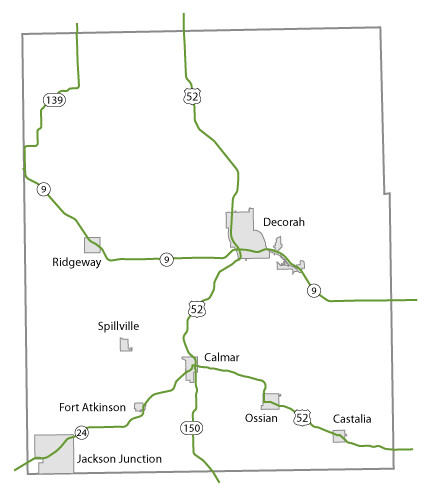
Winneshiek County Maps

Topics:

County Maps
Map of Winneshiek County, Iowa

List items for Winneshiek County Maps

  • Winneshiek color map (3.32 MB) .pdf
  • Winneshiek black/white map (3.28 MB) .pdf
  • Winneshiek DGN Map
  • Winneshiek DWG Map
  • City list
  • County list
  • City traffic maps
  • County traffic maps

  • Calmar map
  • Castalia map
  • Decorah map
  • Fort Atkinson map
  • Jackson Junction map
  • Ossian map
  • Ridgeway map
  • Spillville map

  • Winneshiek County FFC map (3.09 MB) .pdf
  • Decorah FFC map (1.64 MB) .pdf
  • Urban area FFC list
  • County FFC list

  • Winneshiek County FM map (3.72 MB) .PDF
  • County FM list
     

Help

Get help printing PDFs, and find more city and county map information on the Help with Maps page.

Areas Served

  • Winneshiek

Secondary Navigation Menu

  • All Counties

Department of Transportation

Footer Social Media Menu

  • Opens in a new window.
  • Opens in a new window.
  • Opens in a new window.
  • Opens in a new window.

Iowa Department of Transportation Central Office

800 Lincoln Way
Ames, IA 50010

Phone

515-239-1101

How can we help?

Share feedback with us

Footer Menu

Footer

  • Iowa DOT
    • Social Media
    • About
    • Contact
    • Districts
    • Divisions & Bureaus
    • Transportation Matters
    • News
    • Careers
    • Topic Index
  • Vendors & Partners
    • Consultants & Contractors
    • General Procurement & Auctions
    • Transportation Development
  • Online Services
    • DMV Services
    • Schedule an Appointment
    • Take a Practice Test
    • Apps
    • Forms
    • My MVD
    • 511 IA
    • Major Projects
    • Intranet Login
    • Electronic Reference Library
    • Accessibility Assistance
  • Data
    • Analytics
    • Research
    • Transportation Facts
    • Traffic & Safety
    • Iowa Regional Coordinate System (IARCS)
    • Request Crash Data
    • Open Records
    • Digital Delivery
    • Geospatial
    • DMV Statistics & Research
    • Iowa Crash Analysis Tool (ICAT)
    • TraCS & MACH
    • Policies & Statements
    • Maps
  • Archived Documents
Back to home page

Contact Menu

  • Send Feedback

© 2026 State of Iowa - Read our accessibility, data, and privacy policies.