Official State of Iowa Website
Agencies A-Z Programs & Services
Back to home page
Department of Transportation

Main navigation

  • Driver’s Licenses & IDs
    • Schedule an Appointment
    • Find a DMV Location
    • Get or Renew Driver's Licenses, IDs & Permits
    • Driver Education
    • Other Services
    • New to Iowa
    • Commercial Drivers
    • Suspensions & Revocations
    • Mobile ID
    • Military Services
    • Investigation & Identity Protection
    • Forms
  • Registration & Plates
    • Vehicle Registration & Titles
    • Disability Parking & Services
    • License Plates
    • Buy & Sell Vehicles
    • For Dealerships
    • Other Vehicle Services
    • Investigation & Identity Protection
    • Forms
  • Modes of Travel
    • Roads & Highways
    • Public Transit
    • Rail
    • Aviation
    • Bikes
    • Personalized Travel
    • Trails
  • Motor Carriers
    • Get Oversize & Overweight Permits
    • IFTA (International Fuel Tax Agreement)
    • IRP (International Registration Plan)
    • ClearFleet - New IRP & IFTA System
    • UCR (Unified Carrier Registration)
    • Forms
    • Maps
    • Manuals
    • Safety Seminar
    • Proclamations
    • Taxicab Services
    • Paid Rideshare
  • Travel Tools
    • Iowa 511
    • Major Construction Projects
    • Maps
    • Traffic Cameras
    • Highway Helper
Agencies A-Z Online Services

Breadcrumbs

  1. Home
  2. Travel Tools
  3. Maps

City, County & Traffic Maps

Find City, County & Traffic Maps

Browse the various county, city, and traffic maps for the state of Iowa, provided by the Iowa Department of Transportation.
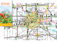
  • All Counties

  • All Cities

  • Federal Functional Classification County Maps

  • Federal Functional Classification Urban Maps

  • County Traffic

  • City Traffic

Highway map of the Des Moines area
Maps

Iowa Transportation Map

The Iowa Transportation Map includes highways, including exit numbers, mileage between exits, points of interest and more.
 

View and print the Iowa Transportation Map

Secondary Navigation Menu

  • Maps
    • Contact
    • District Maps
    • Farm-to-Market Maps
    • Help with Maps
    • Historical Maps
    • Map Data
      • Automatic Traffic Recorder Reports
        • Annual Reports
        • COVID-19 Daily Reports
        • Cumulative Monthly Reports
      • Rural Interstate Speed Information
      • Traffic Counting
      • Turning Movement Diagrams
      • Vehicle Miles Traveled (VMT)
      • Volume of Traffic on the Primary Road System
    • Order a Map
    • Reference Post Maps
    • State Maps
      • Freight Rail Maps
      • Interactive Bike Map
      • Iowa Bikes Maps
      • Iowa Transportation Map
        • Map Pick-Up Locations
        • Websites on the Transportation Map
        • Previous Transportation Maps
      • Motor Carrier Maps
    • City, County & Traffic Maps
      • All Cities
      • All Counties
      • City Traffic
      • County Traffic
      • Federal Functional Classification County Maps
      • Federal Functional Classification Urban Maps

Department of Transportation

Footer Social Media Menu

  • Opens in a new window.
  • Opens in a new window.
  • Opens in a new window.
  • Opens in a new window.

Iowa Department of Transportation Central Office

800 Lincoln Way
Ames, IA 50010

Phone

515-239-1101

How can we help?

Share feedback with us

Footer Menu

Footer

  • Iowa DOT
    • Social Media
    • About
    • Contact
    • Districts
    • Divisions & Bureaus
    • Transportation Matters
    • News
    • Careers
    • Topic Index
  • Vendors & Partners
    • Consultants & Contractors
    • General Procurement & Auctions
    • Transportation Development
  • Online Services
    • DMV Services
    • Schedule an Appointment
    • Take a Practice Test
    • Apps
    • Forms
    • Forms Help
    • My MVD
    • 511 IA
    • Major Projects
    • Intranet Login
    • Electronic Reference Library
    • County Treasurer Resources
  • Data
    • Analytics
    • Research
    • Transportation Facts
    • Traffic & Safety
    • Request Crash Data
    • Open Records
    • Digital Delivery
    • Geospatial Technologies
    • DMV Statistics & Research
    • Iowa Crash Analysis Tool (ICAT)
    • Iowa Regional Coordinate System (RCS)
    • TraCS & MACH
    • Policies & Statements
    • Maps
Back to home page

Contact Menu

  • Send Feedback

© 2025 State of Iowa - Read our accessibility, data, and privacy policies.