Content Information
On this page...
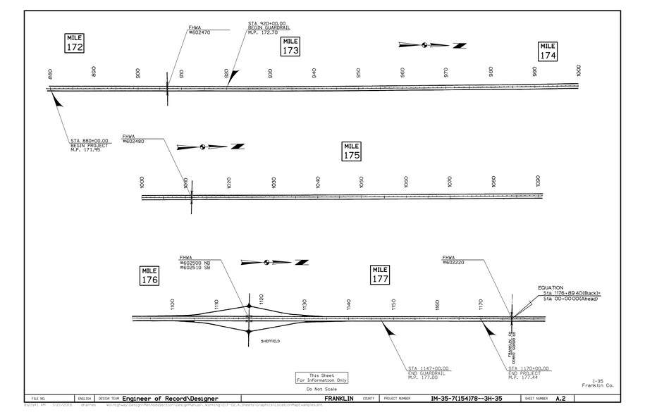
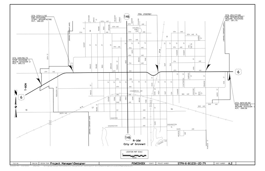
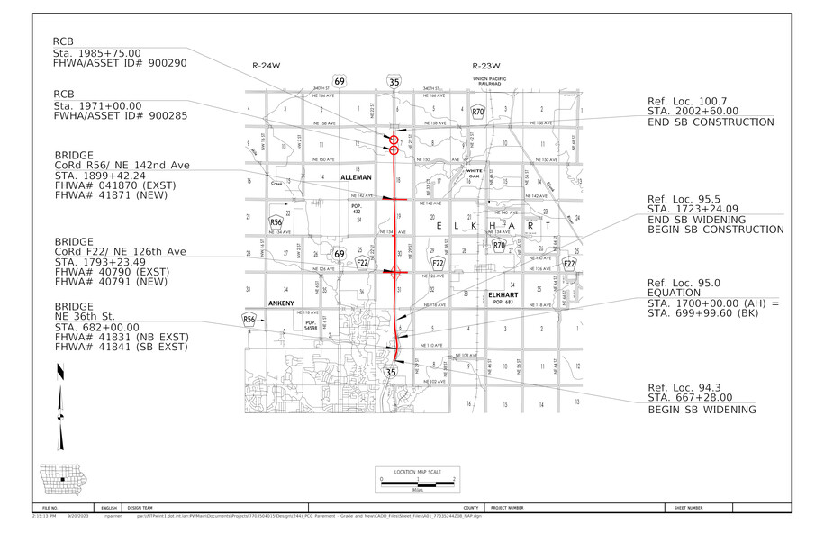
The Location Map Sheet is placed immediately after the Title Sheet. It includes:
Beginning and ending stations and mile posts for the project.
Station equations.
Division breaks.
A Location Map Scale.
FHWA numbers for bridges in the area (access through the GIS Portal).
FRA numbers for railroad crossings (access through the GIS Portal).
A small Iowa state map with the county or counties involved marked if one has not already been placed on the title sheet.
Other information, such as that for a wetland mitigation site, may also be included.
A Location Map Sheet may consist of more than one sheet. An example is a project that requires a rural map and a city map to show the project area.
Use Location Strip Map Sheets for projects such as interstate inlays, resurfacing, or patching. See the Sample Location Map Sheets in Section 1F-02 for an example.
Back to topBridge and Structure Assets on Location Map Sheets
It is very common for multiple structural assets (bridges, culverts, retaining walls, etc.) to be within the project limits shown on the Location Map Sheet. All bridges within the project limits must be shown, no matter the type of project.
Bridges
All bridges with spans over 20 feet in length are considered National Bridge Inventory (NBI) structures and have FHWA numbers. At minimum during any stage of project development, the existing FHWA number for all bridges within the project limits is placed on the Location Map Sheet. When new bridges or bridge replacements are a part of the project, both existing and new FHWA number should be listed as applicable. The Sample Location Map Sheet illustrates how to show bridge information within the project limits.
Other Structures
For other structure types within the project (culverts or other miscellaneous structures), designers only need to locate the structure on the map when the structure is built new, replaced, repaired, extended, or modified for final letting plan development. In these cases, the Bridges and Structures Bureau will provide additional plan sheets (“V” sheets) for the structure. These additional plan sheets will contain information about the structure with an FHWA number or Asset ID in the title block (see example below). This information is placed on the Location Map Sheet. Any miscellaneous structure or culvert not being modified in a project should not need be included on the Location Map Sheet.
Culvert structures can have either an FHWA number or Asset ID based on the inside span length of the culvert. NBI culverts with spans greater than 20 feet have FHWA numbers. Other culverts with 20 foot span or less have Asset ID numbers, see below.
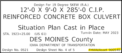
The designer does not need to differentiate between FHWA and Asset ID numbers. The Sample Location Map Sheet illustrates how to show culverts within a project.
Rigid concrete pipes or any other type of drainage pipe is not considered a bridge asset to be located on a map.
Back to topPlan Quality Checklist
- The project map should show generally where the project is located. Specific alignments are not necessary, so an appropriate scale should be chosen.
- Do the beginning and ending stations shown on the map match the beginning and ending stations of the work according to the D Sheets, not just the paving limits?
Are station equations, FHWA numbers for bridges, FHWA/Asset ID numbers for structures, and FRA numbers for railroad crossings shown on the location map?
Sample Location Map Sheets